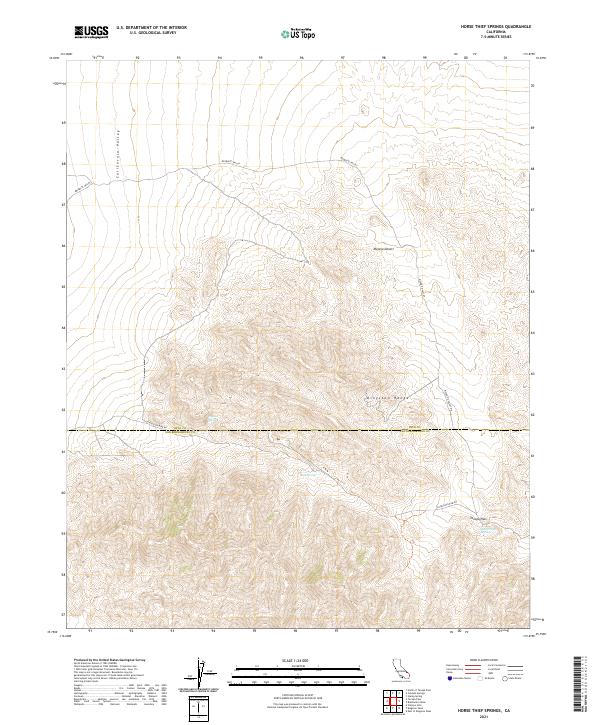
2021 Map of Horse Thief Springs
USGS Topo · Published 2021About this map
Horse Thief Springs provides a critical water source in this high desert landscape, situated near the transition between the Kingston Range and the southern reaches of the Mojave Desert. This 2021 survey illustrates the topographical divide between the California Valley to the west and the Mesquite Valley to the east, capturing a region where elevation and hydrology dictate human passage. The high-altitude crossing at Tecopa Pass serves as a focal point for movement through the mountains, while the presence of Beck Spring and Crystal Spring marks the essential watering holes that historically sustained travelers through these arid basins. The path of Excelsior Mine Rd winds through the southern portion of the map, tracing a route through the complex terrain that straddles the boundary between Inyo and San Bernardino Counties.
Find a feature on this map
16 named features on this map. Tap any name to fly to it.
Don’t see what you’re looking for? This feature index may not catch every label — zoom into the map to look around manually.
Map Details
Editions of this 2021 Horse Thief Springs Map
This is the sole edition of this map. No revisions or reprints were ever made.
Other maps of this area

1910 · Ivanpah
USGS Topo · 1:250,000

1912 · Ivanpah
USGS Topo · 1:250,000

1933 · Avawatz Mountains
USGS Topo · 1:250,000

1942 · Ivanpah
USGS Topo · 1:250,000

1947 · Trona
USGS Topo · 1:250,000

1947 · Kingman
USGS Topo · 1:250,000

1948 · Kingman
USGS Topo · 1:250,000

1948 · Trona
USGS Topo · 1:250,000

1950 · Tecopa
USGS Topo · 1:62,500

1951 · Tecopa
USGS Topo · 1:62,500