2023 Map of Hortonville
USGS Topo · Published 2023About this map
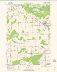
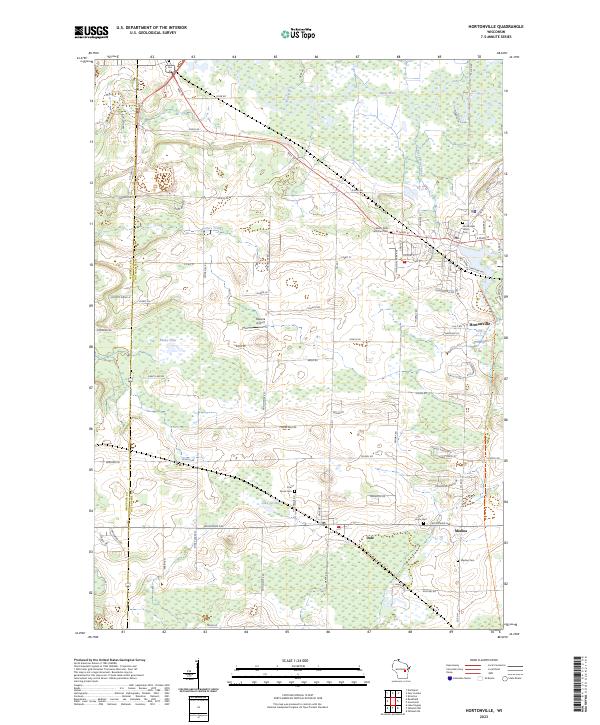
Hortonville and the surrounding agricultural landscapes of Outagamie and Waupaca Counties are defined by a complex network of glacial wetlands and drainage systems. The northern reaches of this map are dominated by the Wolf River and its meandering tributaries, including Potters Creek and Black Otter Creek, which feed into the marshy expanse of Shaky Lake. The settlement pattern follows a distinct east-west orientation along the rail corridors and major thoroughfares like Wisconsin Ave, connecting the villages of Dale and Medina. Genealogy researchers will find significant value in the distribution of community burial sites, including the Hortonville Union Cem, Pine Grove Cem, and Saints Peter and Paul Cem. The transition from old industrial rail routes to modern recreation is visible in the Wiouwash State Trl, while the Dalonia Airport serves as a modern landmark amidst the rural sections of t21n r15e.
Find a feature on this map
51 named features on this map. Tap any name to fly to it.
Don’t see what you’re looking for? This feature index may not catch every label — zoom into the map to look around manually.
Map Details
Editions of this 2023 Hortonville Map
This is the sole edition of this map. No revisions or reprints were ever made.