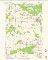
1969 Map of Hortonville
USGS Topo · Published 1976About this map
The Wolf River winds across the northern reaches of this Outagamie County landscape, creating a broad wetland corridor that contrasts with the organized grid of the agricultural uplands. The village of Hortonville serves as the primary hub, situated where the Chicago and North Western railway skirts Black Otter Lake. Further south, the settlements of Dale and Medina anchor a farming district defined by small local landmarks like Daufen Park and numerous rural burial grounds, including Pine Grove Cem and Medina Cem.
Find a feature on this map
50 named features on this map. Tap any name to fly to it.
Don’t see what you’re looking for? This feature index may not catch every label — zoom into the map to look around manually.
Map Details
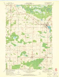
Editions of this 1969 Hortonville Map
2 editions found
Other maps of this area

1955 · Green Bay
USGS Topo · 1:250,000

1956 · New London
USGS Topo · 1:48,000

1956 · Weyauwega
USGS Topo · 1:48,000

1961 · Poy Sippi
USGS Topo · 1:62,500

1961 · Oshkosh
USGS Topo · 1:62,500

1961 · Lake Poygan
USGS Topo · 1:24,000

1961 · Oshkosh NE
USGS Topo · 1:24,000

1961 · Oshkosh NW
USGS Topo · 1:24,000

1969 · New London
USGS Topo · 1:24,000

1969 · Readfield
USGS Topo · 1:24,000