
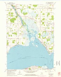
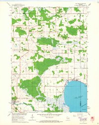
1961 Map of Lake Poygan
USGS Topo · Published 1966About this map
The Wolf River winds through the wetlands of Winnebago County before emptying into the northern reaches of Lake Poygan, a landscape defined by its intricate waterways and low-lying marshes. Small rural centers like Zittau and Orihula serve as anchor points for the surrounding agricultural and riverfront communities. The presence of multiple denominational landmarks, including Immanuel Ch, St Peters Ch, and Zion Ch, alongside several family and community burial grounds such as Wolf River Cem and Becker Cem, provides a detailed record of the mid-century social fabric of Caledonia and Winchester townships.
Find a feature on this map
29 named features on this map. Tap any name to fly to it.
Don’t see what you’re looking for? This feature index may not catch every label — zoom into the map to look around manually.
Map Details
Editions of this 1961 Lake Poygan Map
2 editions found
Other maps of this area

1955 · Green Bay
USGS Topo · 1:250,000

1956 · New London
USGS Topo · 1:48,000

1956 · Weyauwega
USGS Topo · 1:48,000

1961 · Poy Sippi
USGS Topo · 1:62,500

1961 · Oshkosh
USGS Topo · 1:62,500
1961 · Auroraville
USGS Topo · 1:24,000

1961 · Oshkosh NW
USGS Topo · 1:24,000
1961 · Eureka
USGS Topo · 1:24,000
1961 · Omro
USGS Topo · 1:24,000
1961 · Poy Sippi
USGS Topo · 1:24,000