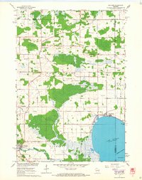
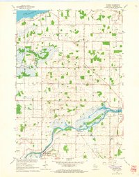
1961 Map of Poy Sippi
USGS Topo · Published 1968About this map
The Pine River meanders across this mid-century landscape of Central Wisconsin, meeting the marshy western reaches of Lake Poygan. The settlement of Poy Sippi serves as a primary hub in the south, while the shoreline community of Tustin sits at the water's edge to the east. The terrain is characterized by extensive wetlands and glacial drainage patterns, evidenced by the courses of Mosquito Creek and Alder Creek. Rural life is centered around a network of crossroads settlements and parish institutions, including West Bloomfield, Metz, and Brushville. Genealogists and local historians can trace numerous community landmarks such as Emmaus Ch, St Johns Sch, and several family or church-affiliated burial grounds like Prellwitz Cem and Concordia Cem. The presence of many Gravel Pits scattered throughout the townships of Bloomfield and Poysippi highlights the local extractive industry that supported the region's road and agricultural infrastructure.
Find a feature on this map
37 named features on this map. Tap any name to fly to it.
Don’t see what you’re looking for? This feature index may not catch every label — zoom into the map to look around manually.
Map Details
Editions of this 1961 Poy Sippi Map
2 editions found
Other maps of this area

1955 · Green Bay
USGS Topo · 1:250,000

1956 · Weyauwega
USGS Topo · 1:48,000

1957 · Waupaca
USGS Topo · 1:48,000

1961 · Poy Sippi
USGS Topo · 1:62,500

1961 · Redgranite
USGS Topo · 1:62,500

1961 · Saxeville
USGS Topo · 1:24,000

1961 · Lake Poygan
USGS Topo · 1:24,000
1961 · Redgranite
USGS Topo · 1:24,000
1961 · Auroraville
USGS Topo · 1:24,000
1961 · Eureka
USGS Topo · 1:24,000