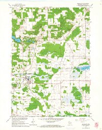
1961 Map of Redgranite
USGS Topo · Published 1966About this map
Redgranite and the neighboring village of Lohrville serve as the primary hubs in this early 1960s study of eastern Waushara County. The landscape is defined by its transition from agricultural fields and scattered woodlots to the glacial kettle lakes of the west, including Pearl Lake, Middle Lake, and Taylor Lake. The local economy of the era is visibly tied to the earth, marked by numerous Gravel Pits and the Quarry operations near the town centers.
Find a feature on this map
24 named features on this map. Tap any name to fly to it.
Don’t see what you’re looking for? This feature index may not catch every label — zoom into the map to look around manually.
Map Details
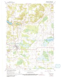
Editions of this 1961 Redgranite Map
2 editions found
Other maps of this area

1915 · Neshkoro
USGS Topo · 1:48,000

1916 · Ripon
USGS Topo · 1:48,000

1918 · Neshkoro
USGS Topo · 1:62,500

1918 · Ripon
USGS Topo · 1:62,500

1955 · Green Bay
USGS Topo · 1:250,000

1956 · Ripon
USGS Topo · 1:62,500

1957 · Madison
USGS Topo · 1:250,000

1960 · Madison
USGS Topo · 1:250,000

1961 · Poy Sippi
USGS Topo · 1:62,500

1961 · Redgranite
USGS Topo · 1:62,500