
1961 Map of Oshkosh NW
USGS Topo · Published 1966About this map
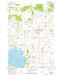
The marshy lowlands of the Rat River dominate this early 1960s landscape, illustrating a complex hydrological network that feeds into the northern reaches of Lake Winneconne. The terrain is marked by a clear agricultural-industrial divide, where dozens of small Gravel Pits and Quarries dot the landscape near the small crossroads of Winchester and Larsen. These extraction sites, often located on higher ground near the Winchester Cem, highlight the local economy's reliance on the region's glacial deposits.
Find a feature on this map
32 named features on this map. Tap any name to fly to it.
Don’t see what you’re looking for? This feature index may not catch every label — zoom into the map to look around manually.
Map Details
Editions of this 1961 Oshkosh NW Map
2 editions found
Other maps of this area

1955 · Green Bay
USGS Topo · 1:250,000

1956 · New London
USGS Topo · 1:48,000

1956 · Weyauwega
USGS Topo · 1:48,000

1961 · Oshkosh
USGS Topo · 1:24,000

1961 · Poy Sippi
USGS Topo · 1:62,500

1961 · Oshkosh
USGS Topo · 1:62,500

1961 · Lake Poygan
USGS Topo · 1:24,000

1961 · Oshkosh NE
USGS Topo · 1:24,000
1961 · Eureka
USGS Topo · 1:24,000
1961 · Omro
USGS Topo · 1:24,000