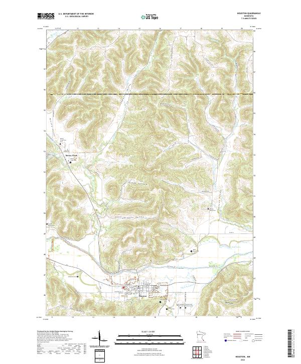
2022 Map of Houston
USGS Topo · Published 2022About this map
The Root River and its S Fork Root River define the lower elevations of this landscape, where the city of Houston serves as a local hub. The terrain is characterized by deep valleys such as Looney Valley, Paradise Valley, and Wiscoy Valley, separated by prominent features like Stinson Ridge and Oak Ridge. This topography created a clustered settlement pattern, with numerous small family and community burial sites scattered throughout the hollows. Genealogists will find a wealth of specific locations including the Omodt Family Cem, Johnstons Cem, and the First Swedish Baptist Cem near the riverbanks.
Find a feature on this map
70 named features on this map. Tap any name to fly to it.
Don’t see what you’re looking for? This feature index may not catch every label — zoom into the map to look around manually.
Map Details
Editions of this 2022 Houston Map
This is the sole edition of this map. No revisions or reprints were ever made.
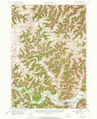
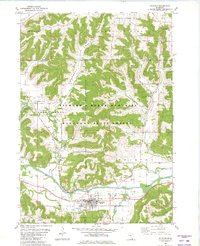
Historical Maps of Money Creek Through Time
3 maps found