2022 Map of Humboldt
USGS Topo · Published 2022About this map
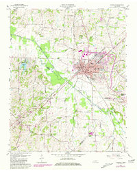
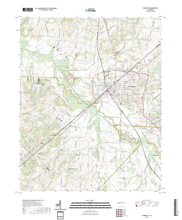
Humboldt is the primary center of activity in this West Tennessee landscape, situated where the Middle Fork Forked Deer River and its various tributaries like Sugar Cr and Little Sugar Cr define the drainage of Gibson County. The map documents a blend of established municipal life and rural heritage, anchored by the Humboldt Municipal Airport on the eastern edge. To the south and west, smaller communities such as Gadsden, Antioch, and Mason Grove are connected by a network of local roads and thoroughfares including N Central Ave. The region is notably marked by numerous family and community burial grounds, such as Rose Hill Cem, Oak Hill Cem, and Motley Cem, which serve as vital points of reference for local genealogical research and historical study of the county's early settlement patterns.
Find a feature on this map
150 named features on this map. Tap any name to fly to it.
Don’t see what you’re looking for? This feature index may not catch every label — zoom into the map to look around manually.
Map Details
Editions of this 2022 Humboldt Map
This is the sole edition of this map. No revisions or reprints were ever made.