2024 Map of Huntington
USGS Topo · Published 2024About this map
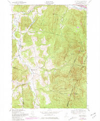
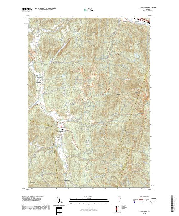
Huntington and Huntington Center anchor the settlement pattern of this Vermont landscape, where the Huntington River carves a valley between the prominent peaks of the Green Mountains. The terrain is defined by significant elevations including Camels Hump, Mt Ethan Allen, and Mt Ira Allen, which draw prominent long-distance footpaths like the Long Trl and Catamount Trl. In the northern reaches, the Winooski River flows past East Bolton and Bolton Cem, marking the lowlands that contrast with the high ridgelines of Robbins Mtn and Burnt Rock Mtn. To the south, the village of Hanksville sits near the headwaters of numerous brooks, such as Jones Brook and Carpenter Brook. Local genealogy and history are preserved at sites like Maplewood Cem and Huntington Center Cem, while Teal Farm Airport indicates modern land use tucked into the valley floor.
Find a feature on this map
83 named features on this map. Tap any name to fly to it.
Don’t see what you’re looking for? This feature index may not catch every label — zoom into the map to look around manually.
Map Details
Editions of this 2024 Huntington Map
This is the sole edition of this map. No revisions or reprints were ever made.