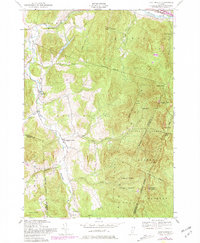
1948 Map of Huntington
USGS Topo · Published 1981About this map
Huntington River carves a deep valley through the Green Mountains in this late 1940s topography, later revised with 1970s structural updates. The map captures the small-scale settlement patterns of Huntington, Huntington Center, and Hanksville, where homes and farms cling to the narrow lowlands along Hollow Brook and Brush Brook. To the east, the terrain rises sharply toward the iconic summit of Camels Hump (The Lion), a landscape dominated by the Camels Hump State Forest. The inclusion of The Long Trail and remote shelters like Gorham Lodge and Montclair Glen Camp highlights the area's established identity as a hiking destination. Along the northern edge, the Winooski River corridor facilitates vital transport via the Central Vermont railroad, contrasting the quiet, localized road networks of the southern townships. Educational history is preserved through markers for Towers Sch and School No 12, anchoring the rural social geography of the era.
Find a feature on this map
44 named features on this map. Tap any name to fly to it.
Don’t see what you’re looking for? This feature index may not catch every label — zoom into the map to look around manually.
Map Details
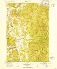
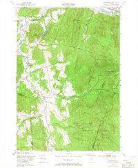
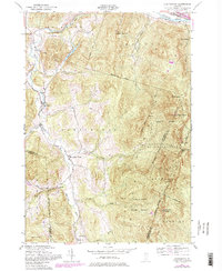
Editions of this 1948 Huntington Map
4 editions found
Other maps of this area

1903 · Middlebury
USGS Topo · 1:62,500

1905 · Middlebury
USGS Topo · 1:62,500

1906 · Burlington
USGS Topo · 1:62,500

1919 · Burlington
USGS Topo · 1:62,500

1919 · Lincoln Mountain
USGS Topo · 1:62,500

1920 · Lincoln Mountain
USGS Topo · 1:48,000

1920 · Middlebury
USGS Topo · 1:62,500

1921 · Richmond
USGS Topo · 1:48,000

1921 · Lincoln Mountain
USGS Topo · 1:62,500

1924 · Camels Hump
USGS Topo · 1:62,500