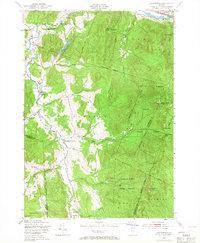
1948 Map of Huntington
USGS Topo · Published 1967About this map
The Huntington River valley defines the character of this 1948 survey, where small agricultural and timber-reliant settlements like Huntington Center and Hanksville are concentrated along the narrow floor between massive ridges. Life in this period revolved around the river and the steep mountain flanks, evidenced by a Sawmill near the southern edge and a local Quarry tucked against the hills. To the east, the landscape transitions into the high peaks of the Camels Hump State Forest, where the summit of Camels Hump (The Lion) and The Long Trail served as prominent landmarks for hikers and forestry workers alike.
Find a feature on this map
49 named features on this map. Tap any name to fly to it.
Don’t see what you’re looking for? This feature index may not catch every label — zoom into the map to look around manually.
Map Details
Editions of this 1948 Huntington Map
4 editions found
Other maps of this area

1903 · Middlebury
USGS Topo · 1:62,500

1905 · Middlebury
USGS Topo · 1:62,500

1906 · Burlington
USGS Topo · 1:62,500

1919 · Burlington
USGS Topo · 1:62,500

1919 · Lincoln Mountain
USGS Topo · 1:62,500

1920 · Lincoln Mountain
USGS Topo · 1:48,000

1920 · Middlebury
USGS Topo · 1:62,500

1921 · Richmond
USGS Topo · 1:48,000

1921 · Lincoln Mountain
USGS Topo · 1:62,500

1924 · Camels Hump
USGS Topo · 1:62,500