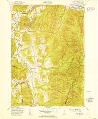
1948 Map of Huntington
USGS Topo · Published 1953About this map
The Huntington River valley defines the character of this late 1940s landscape, where small agricultural settlements like Huntington Center and Hanksville are interspersed with local timber and stone industries. Education in these rural townships still relied on local landmarks such as Towers Sch, Fiddock Sch, and School No 12, which are carefully plotted alongside a Quarry and a Sawmill.
Find a feature on this map
41 named features on this map. Tap any name to fly to it.
Don’t see what you’re looking for? This feature index may not catch every label — zoom into the map to look around manually.
Map Details
Editions of this 1948 Huntington Map
4 editions found
Other maps of this area

1903 · Middlebury
USGS Topo · 1:62,500

1905 · Middlebury
USGS Topo · 1:62,500

1906 · Burlington
USGS Topo · 1:62,500

1919 · Burlington
USGS Topo · 1:62,500

1919 · Lincoln Mountain
USGS Topo · 1:62,500

1920 · Lincoln Mountain
USGS Topo · 1:48,000

1920 · Middlebury
USGS Topo · 1:62,500

1921 · Richmond
USGS Topo · 1:48,000

1921 · Lincoln Mountain
USGS Topo · 1:62,500

1924 · Camels Hump
USGS Topo · 1:62,500