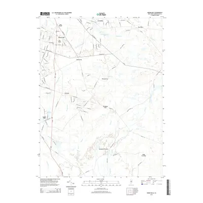
2014 Map of Indian Mills
USGS Topo · Published 2014About this map
Hampton Furnace and the winding course of the Batsto River define this portion of the New Jersey Pine Barrens. The landscape is characterized by a complex network of tea-colored waterways, including Bread and Cheese Run, Skit Br, and Friendship Cr, which reflect the region's historic reliance on water for early industry. Several small, historically significant settlements are scattered across the terrain, from Indian Mills and Tabernacle in the west to the more isolated Bozuretown and Sooy Place to the northeast.
Find a feature on this map
102 named features on this map. Tap any name to fly to it.
Don’t see what you’re looking for? This feature index may not catch every label — zoom into the map to look around manually.
Map Details
Editions of this 2014 Indian Mills Map
This is the sole edition of this map. No revisions or reprints were ever made.
Other maps of this area

1888 · Pemberton
USGS Topo · 1:62,500

1888 · Mount Holly
USGS Topo · 1:62,500

1890 · Hammonton
USGS Topo · 1:62,500

1890 · Mullica
USGS Topo · 1:62,500

1894 · Hammonton
USGS Topo · 1:62,500

1894 · Pemberton
USGS Topo · 1:62,500

1894 · Mount Holly
USGS Topo · 1:62,500

1894 · Mullica
USGS Topo · 1:62,500

1898 · Pemberton
USGS Topo · 1:62,500

1898 · Mount Holly
USGS Topo · 1:62,500
Featured Places
- Southampton Township, NJ
- Tabernacle Township, NJ
- Shamong Township, NJ
- Indian Mills, NJ
- Fox Chase, Tabernacle Township