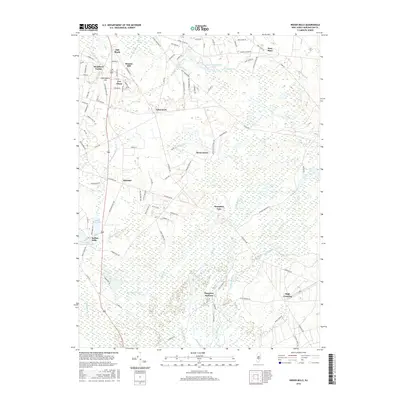
2016 Map of Indian Mills
USGS Topo · Published 2016About this map
Indian Mills and the surrounding pine barrens of Burlington County are defined by a network of slow-moving waterways and historic industrial sites. The landscape is dominated by the Bear Swamp and the headwaters of the Batsto River, which supported early economic hubs like Hampton Furnace and Moores Mill. These sites represent the transition from colonial-era resource extraction to a modern rural-residential character. Settlements like Tabernacle and Oriental are connected by a dense web of local roads such as Tuckerton Rd and Carranza Rd, reflecting the area's long history as a crossroads. Notable water features, including Indian Mills Lake and Indian Mills Sawmill Pond, indicate the lasting influence of dammed streams on the local geography, while Camp Inawendiwin highlights the area's role in regional recreation and conservation.
Find a feature on this map
101 named features on this map. Tap any name to fly to it.
Don’t see what you’re looking for? This feature index may not catch every label — zoom into the map to look around manually.
Map Details
Editions of this 2016 Indian Mills Map
This is the sole edition of this map. No revisions or reprints were ever made.
Other maps of this area

1888 · Pemberton
USGS Topo · 1:62,500

1888 · Mount Holly
USGS Topo · 1:62,500

1890 · Hammonton
USGS Topo · 1:62,500

1890 · Mullica
USGS Topo · 1:62,500

1894 · Hammonton
USGS Topo · 1:62,500

1894 · Pemberton
USGS Topo · 1:62,500

1894 · Mount Holly
USGS Topo · 1:62,500

1894 · Mullica
USGS Topo · 1:62,500

1898 · Pemberton
USGS Topo · 1:62,500

1898 · Mount Holly
USGS Topo · 1:62,500
Featured Places
- Southampton Township, NJ
- Tabernacle Township, NJ
- Shamong Township, NJ
- Indian Mills, NJ
- Fox Chase, Tabernacle Township