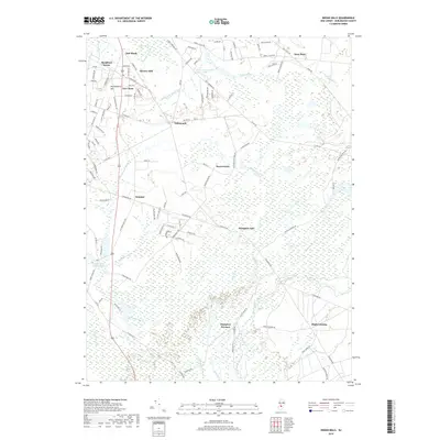
2019 Map of Indian Mills
USGS Topo · Published 2019About this map
Hampton Furnace and the surrounding pine wetlands anchor this part of Burlington County, where the legacy of early industry meets modern preservation. The drainage patterns of the Batsto River, Bear Swamp River, and Springers Brook define the landscape, punctuated by historic points like Hampton Gate and High Crossing. Settled areas such as Tabernacle and Bozuretown appear alongside recreation and resource sites like Camp Inawendiwin Lake and the Indian Mills Sawmill Pond. The road network, including Us 206 and various county routes, connects these established communities to smaller named locales like Oak Shade and Fox Chase. The presence of Bear Swamp and numerous runs, such as Bread and Cheese Run, illustrates the water-heavy nature of the terrain that once supported local mills and furnaces.
Find a feature on this map
107 named features on this map. Tap any name to fly to it.
Don’t see what you’re looking for? This feature index may not catch every label — zoom into the map to look around manually.
Map Details
Editions of this 2019 Indian Mills Map
This is the sole edition of this map. No revisions or reprints were ever made.
Other maps of this area

1888 · Pemberton
USGS Topo · 1:62,500

1888 · Mount Holly
USGS Topo · 1:62,500

1890 · Hammonton
USGS Topo · 1:62,500

1890 · Mullica
USGS Topo · 1:62,500

1894 · Hammonton
USGS Topo · 1:62,500

1894 · Pemberton
USGS Topo · 1:62,500

1894 · Mount Holly
USGS Topo · 1:62,500

1894 · Mullica
USGS Topo · 1:62,500

1898 · Pemberton
USGS Topo · 1:62,500

1898 · Mount Holly
USGS Topo · 1:62,500
Featured Places
- Southampton Township, NJ
- Tabernacle Township, NJ
- Shamong Township, NJ
- Indian Mills, NJ
- Fox Chase, Tabernacle Township