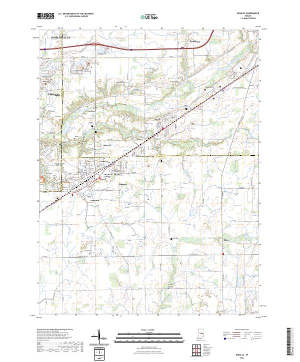
2022 Map of Ingalls
USGS Topo · Published 2022About this map
Ingalls and Fortville anchor this map of the central Indiana countryside, situated where the borders of Madison, Hamilton, and Hancock counties converge. The landscape is defined by an extensive network of drainage ditches and creeks, including the McFadden Ditch, Mingle Ditch, and Sugar Creek, which supported the region's agricultural development. Settlement patterns are concentrated along the Pendleton Pike corridor, showing the residential expansion of communities like Helmcrest, Colonial Village, and Sunview.
Find a feature on this map
135 named features on this map. Tap any name to fly to it.
Don’t see what you’re looking for? This feature index may not catch every label — zoom into the map to look around manually.
Map Details
Editions of this 2022 Ingalls Map
This is the sole edition of this map. No revisions or reprints were ever made.
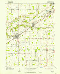
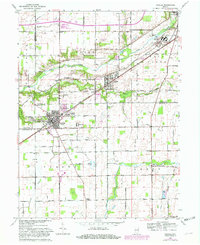
Historical Maps of Turnberry Through Time
3 maps found