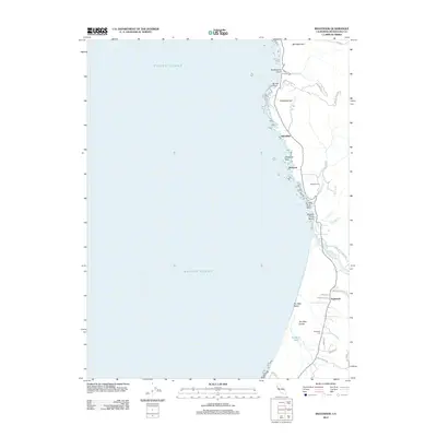
2012 Map of Inglenook
USGS Topo · Published 2012About this map
Inglenook and the adjacent Mendocino coastline are defined by a complex geography where the Pacific Ocean meets shifting sands and narrow coastal drainages. This northern reach of the California coast features the expansive Ten Mile Dunes and Ten Mile Beach, anchored by the mouth of the Ten Mile River. The map documents established local landmarks including the Inglenook Cem and Newport Cem, providing critical touchpoints for genealogists and local historians tracing families in this maritime landscape.
Find a feature on this map
34 named features on this map. Tap any name to fly to it.
Don’t see what you’re looking for? This feature index may not catch every label — zoom into the map to look around manually.
Map Details
Editions of this 2012 Inglenook Map
This is the sole edition of this map. No revisions or reprints were ever made.
Other maps of this area

1920 · Glenblair
USGS Topo · 1:62,500

1920 · Fort Bragg
USGS Topo · 1:62,500

1921 · Westport
USGS Topo · 1:62,500

1921 · Branscomb
USGS Topo · 1:62,500

1943 · Glenblair
USGS Topo · 1:62,500

1943 · Fort Bragg
USGS Topo · 1:62,500

1950 · Cape Vizcaino
USGS Topo · 1:62,500

1951 · Cape Vizcaino
USGS Topo · 1:62,500

1951 · Branscomb
USGS Topo · 1:62,500

1957 · Ukiah
USGS Topo · 1:250,000