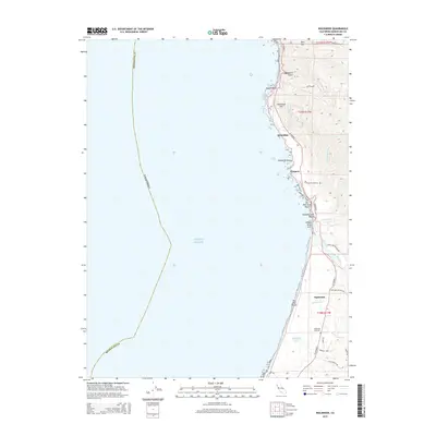
2015 Map of Inglenook
USGS Topo · Published 2015About this map
The Mendocino coastline is documented here through a transition of rugged maritime geography and quiet coastal settlements. N Highway 1 serves as the primary artery, connecting the historic locations of Kibesillah and Newport to the agricultural and marshland surroundings of Inglenook. This area shows a landscape defined by its interface with the Pacific Ocean, featuring prominent landmarks like Bruhel Point and the wave-carved Whale Rock Arch. Further inland, the map traces the winding course of the Ten Mile River and its lower estuary, providing a clear view of the hydrological network that includes Inglenook Creek and Sandhill Lake. Genealogists will find the locations of the Newport Cemetery and Inglenook Cemetery particularly useful for tracing local history. The map also delineates older transport routes such as Old Cahto Rd and timber-related infrastructure like Camp One Ten Mile Rd.
Find a feature on this map
34 named features on this map. Tap any name to fly to it.
Don’t see what you’re looking for? This feature index may not catch every label — zoom into the map to look around manually.
Map Details
Editions of this 2015 Inglenook Map
This is the sole edition of this map. No revisions or reprints were ever made.
Other maps of this area

1920 · Glenblair
USGS Topo · 1:62,500

1920 · Fort Bragg
USGS Topo · 1:62,500

1921 · Westport
USGS Topo · 1:62,500

1921 · Branscomb
USGS Topo · 1:62,500

1943 · Glenblair
USGS Topo · 1:62,500

1943 · Fort Bragg
USGS Topo · 1:62,500

1950 · Cape Vizcaino
USGS Topo · 1:62,500

1951 · Cape Vizcaino
USGS Topo · 1:62,500

1951 · Branscomb
USGS Topo · 1:62,500

1957 · Ukiah
USGS Topo · 1:250,000