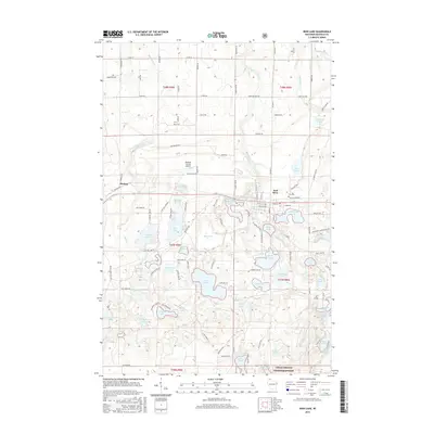
2015 Map of Iron Lake
USGS Topo · Published 2015About this map
Iron River serves as the primary hub in this northern Wisconsin landscape, situated along the Tri Co Corridor rail trail. The area is defined by an intricate network of glacial lakes and wetlands, including the expansive Iron Lake, Crystal Lake, and Spider Lake. This 2015 survey illustrates the modern layout of the town, from the City Cem to the local Bayfield County Airport located to the west. Much of the southern terrain is dominated by the Chequamegon National Forest, where the land transitions into a denser woodland pattern dotted with smaller water bodies like Lake Millicent and Ahmeek Lake. The settlement of Muskeg sits at the western edge of the quadrangle, connected to the larger community by a series of county highways and local roads such as Spring Lake Rd and Korpi Rd.
Find a feature on this map
164 named features on this map. Tap any name to fly to it.
Don’t see what you’re looking for? This feature index may not catch every label — zoom into the map to look around manually.
Map Details
Editions of this 2015 Iron Lake Map
This is the sole edition of this map. No revisions or reprints were ever made.
Other maps of this area

1943 · Iron Lake
USGS Topo · 1:48,000

1944 · Drummond
USGS Topo · 1:48,000

1945 · Highland
USGS Topo · 1:48,000

1947 · Drummond
USGS Topo · 1:48,000

1947 · Brule
USGS Topo · 1:48,000

1947 · Iron Lake
USGS Topo · 1:48,000

1949 · Highland
USGS Topo · 1:48,000

1953 · Ashland
USGS Topo · 1:250,000

1958 · Ashland
USGS Topo · 1:250,000

1961 · Iron Lake SW
USGS Topo · 1:24,000