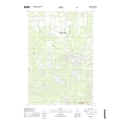
2018 Map of Iron Lake
USGS Topo · Published 2018About this map
Iron River serves as the central hub of this northern Wisconsin landscape, situated just north of a dense network of glacial lakes. This 2018 survey highlights the town's local infrastructure, including the Iron River City Cem and the nearby Bayfield County Airport. To the west, the smaller settlement of Muskeg sits along the Tri Co Corridor, a significant recreational route passing through the region. The southern half of the map is dominated by the sprawling waters of Iron Lake, Bismarck Lake, and Spider Lake, illustrating the post-glacial topography typical of the area. A portion of the Chequamegon National Forest anchors the southeast corner, preserving the wooded character of the county. The road network, including family-named routes like Szczygiel Rd and Mortenson Rd, provides essential context for local genealogists and land-use researchers tracking property boundaries and rural development.
Find a feature on this map
74 named features on this map. Tap any name to fly to it.
Don’t see what you’re looking for? This feature index may not catch every label — zoom into the map to look around manually.
Map Details
Editions of this 2018 Iron Lake Map
This is the sole edition of this map. No revisions or reprints were ever made.
Other maps of this area

1943 · Iron Lake
USGS Topo · 1:48,000

1944 · Drummond
USGS Topo · 1:48,000

1945 · Highland
USGS Topo · 1:48,000

1947 · Drummond
USGS Topo · 1:48,000

1947 · Brule
USGS Topo · 1:48,000

1947 · Iron Lake
USGS Topo · 1:48,000

1949 · Highland
USGS Topo · 1:48,000

1953 · Ashland
USGS Topo · 1:250,000

1958 · Ashland
USGS Topo · 1:250,000

1961 · Iron Lake SW
USGS Topo · 1:24,000