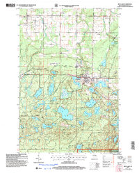
2005 Map of Iron Lake
USGS Topo · Published 2006About this map
Iron River serves as the primary hub of this northern Wisconsin landscape, situated along the Tri-County Corridor and surrounded by a dense network of glacial lakes. The settlement pattern reflects a mix of small-town infrastructure and timber-era history, evidenced by the City Cem and the nearby Fairground. To the north, the town of Oulu is marked by the Oulu Sch and the Oulu Pioneer Memorial Park, while the southern reaches of the quadrangle are dominated by the Chequamegon National Forest.
Find a feature on this map
75 named features on this map. Tap any name to fly to it.
Don’t see what you’re looking for? This feature index may not catch every label — zoom into the map to look around manually.
Map Details
Editions of this 2005 Iron Lake Map
This is the sole edition of this map. No revisions or reprints were ever made.
Other maps of this area

1943 · Iron Lake
USGS Topo · 1:48,000

1944 · Drummond
USGS Topo · 1:48,000

1945 · Highland
USGS Topo · 1:48,000

1947 · Drummond
USGS Topo · 1:48,000

1947 · Brule
USGS Topo · 1:48,000

1947 · Iron Lake
USGS Topo · 1:48,000

1949 · Highland
USGS Topo · 1:48,000

1953 · Ashland
USGS Topo · 1:250,000

1958 · Ashland
USGS Topo · 1:250,000

1961 · Iron Lake SW
USGS Topo · 1:24,000