2024 Map of Irvington
USGS Topo · Published 2024About this map
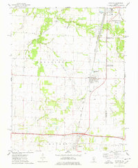
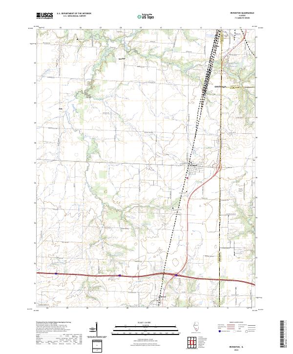
Centralia and the adjacent community of Wamac anchor the northern edge of this Illinois landscape, where the borders of Washington, Marion, and Jefferson Counties converge. The village of Irvington serves as a central hub for the surrounding agricultural tracts, with the smaller settlement of Richview situated further south. This modern survey illustrates a well-defined grid of rural roads named for native timber, such as Hedge Tree Rd, Post Oak Rd, and Chestnut Rd, which trace the drainage basins of Grand Point Creek and Webster Creek. Genealogists will find several notable burial sites including Harres Cem, Irvington Cem, and Grand Point Cem. The presence of the Prairie Airport and the Greenview Country Club Pond One signifies the area's contemporary development alongside long-standing rural hamlets like Noltings and Alda.
Find a feature on this map
41 named features on this map. Tap any name to fly to it.
Don’t see what you’re looking for? This feature index may not catch every label — zoom into the map to look around manually.
Map Details
Editions of this 2024 Irvington Map
This is the sole edition of this map. No revisions or reprints were ever made.