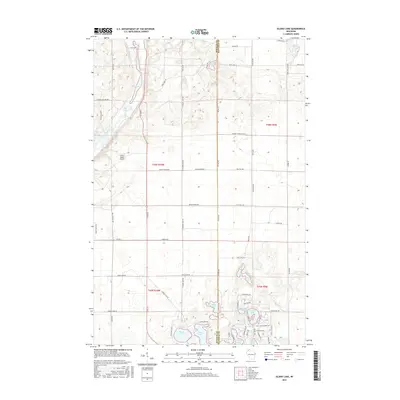
2015 Map of Island Lake
USGS Topo · Published 2015About this map
The Bois Brule River snakes through the western portion of this landscape, its path marked by a series of distinct river features including Wildcat Rapids, Big Twin Rapids, and The Falls Rapids. This glacial terrain is characterized by a high density of water bodies, with Lucius Lake and Big Lake situated along the northern stretch of the river. To the south and east, the map reveals a complex system of smaller lakes such as Island Lake, Blue Lake, and Loon Lake, many of which are connected by a network of local roads and recreational tracks like Blue Lake Rd and S Loon Lake Rd. The presence of the Cedar Island Airport and the clear demarcation of the Douglas Co and Bayfield Co line provide essential geographic context for this Northwoods region during the mid-2010s.
Find a feature on this map
69 named features on this map. Tap any name to fly to it.
Don’t see what you’re looking for? This feature index may not catch every label — zoom into the map to look around manually.
Map Details
Editions of this 2015 Island Lake Map
This is the sole edition of this map. No revisions or reprints were ever made.
Other maps of this area

1943 · Iron Lake
USGS Topo · 1:48,000

1944 · Drummond
USGS Topo · 1:48,000

1945 · Highland
USGS Topo · 1:48,000

1947 · Drummond
USGS Topo · 1:48,000

1947 · Brule
USGS Topo · 1:48,000

1947 · Iron Lake
USGS Topo · 1:48,000

1949 · Highland
USGS Topo · 1:48,000

1953 · Ashland
USGS Topo · 1:250,000

1954 · Lake Nebagamon
USGS Topo · 1:24,000

1958 · Ashland
USGS Topo · 1:250,000