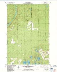
1984 Map of Island Lake
USGS Topo · Published 1984About this map
Brule River State Forest dominates this landscape, where the Brule River winds through a series of significant whitewater features including Wildcat Rapids, Little Twin Rapids, and The Falls Rapids. The presence of the Cedar Island Estate and the adjacent Cedar Island Airport points to the area's legacy as a retreat for prominent figures, situated near the river's bends.
Find a feature on this map
40 named features on this map. Tap any name to fly to it.
Don’t see what you’re looking for? This feature index may not catch every label — zoom into the map to look around manually.
Map Details
Editions of this 1984 Island Lake Map
This is the sole edition of this map. No revisions or reprints were ever made.
Other maps of this area

1943 · Iron Lake
USGS Topo · 1:48,000

1944 · Drummond
USGS Topo · 1:48,000

1945 · Highland
USGS Topo · 1:48,000

1947 · Drummond
USGS Topo · 1:48,000

1947 · Brule
USGS Topo · 1:48,000

1947 · Iron Lake
USGS Topo · 1:48,000

1949 · Highland
USGS Topo · 1:48,000

1953 · Ashland
USGS Topo · 1:250,000

1954 · Lake Nebagamon
USGS Topo · 1:24,000

1958 · Ashland
USGS Topo · 1:250,000