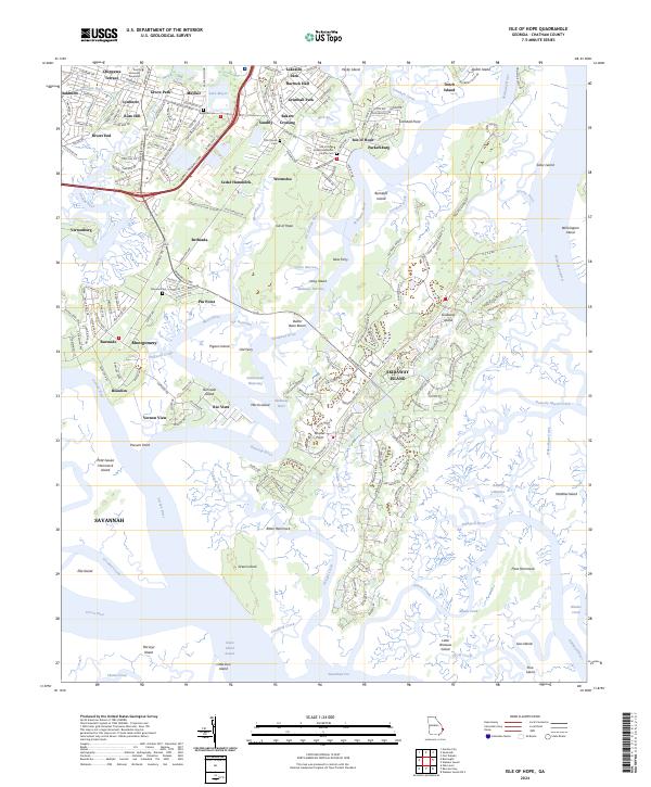
2024 Map of Isle of Hope
USGS Topo · Published 2024About this map
Wormsloe and the community of Isle of Hope anchor this coastal landscape, where the tides of the Skidaway River and Moon River shape the Lowcountry geography. The map documents a dense network of suburban and historic settlements south of Savannah, including Pin Point, Sandfly, and Beaulieu. Notable genealogical sites are found throughout the area, including Pinpoint Cem, Eugenia Cem, and the Isle of Hope United Methodist Church Cem. The eastern portion of the sheet transitions into the salt marshes and maritime forests of the Wassaw National Wildlife Refuge, showcasing the preservation of the Georgia coast. Modern transportation corridors like the Harry S Truman Pkwy and Diamond Cswy connect these island communities to the mainland, while numerous creeks and narrows highlight the region's enduring maritime character.
Find a feature on this map
89 named features on this map. Tap any name to fly to it.
Don’t see what you’re looking for? This feature index may not catch every label — zoom into the map to look around manually.
Map Details
Editions of this 2024 Isle of Hope Map
This is the sole edition of this map. No revisions or reprints were ever made.
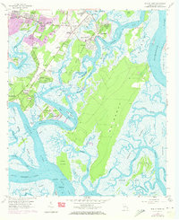
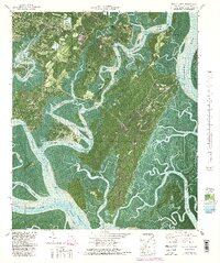
Historical Maps of Pin Point Through Time
3 maps found