Old Maps of Chatham County, Georgia
Explore 159 old maps of Chatham County, spanning from 1920 to today. These high-resolution historic maps reveal how streets, neighborhoods, landmarks, and natural features evolved over time — perfect for genealogy, metal detecting, research, and local history exploration.
What you can do with these maps:
- See how Chatham County changed over time: Compare historical maps to modern-day views to trace roads, homesites, rail lines & more.
- View detailed metadata: Each map includes creators, publishers, year, scale, and archive source.
- Overlay maps with satellite & LiDAR: Visualize the past alongside modern tools to explore terrain & human change.
- Trusted historical sources: Maps sourced from the USGS, Library of Congress, and other archives.
- Access maps your way: View online, download high-res files, or order prints for personal or research use.
Start exploring old maps of Chatham County to uncover forgotten places, hidden landmarks, and the deep history beneath your feet.
Chatham County, GA maps
(159)- 1920 Map of Meldrim
 1920 Meldrim1920 Print · USGSCoastal Georgia during the early post-war period is defined here by the winding Ogeechee River and a busy intersection of rail lines. Genealogists and researchers can trace family roots near Clyde or locate rural landmarks like Zion Church and Miller Chapel.
 - 1920 Map of Wassaw Sound
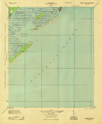
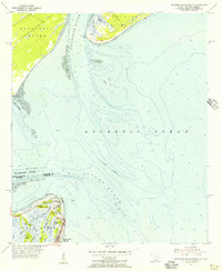
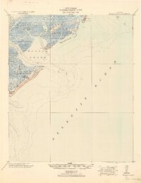 1920 Wassaw Sound1920 Print · USGSCoastal Georgia at the end of the Great War era reveals a landscape of tidal marshes and strategic barrier islands. Researchers can trace historic landmarks like the Great Wassaw Old Battery, the Cup of Hotel, and the winding Wilmington River.
 - 1920 Map of Bluffton
 1920 Bluffton1920 Print · USGSThe Georgia and South Carolina coastlines meet here in the early twentieth century, showing a world defined by tidal rivers and island outposts. Researchers can trace historic maritime landmarks like Ft. Pulaski, the Long Island Ferry, and family settlements at Spanish Wells or Hickory Bluff.
 - 1920 Map of Limerick, 1928 Print
 1920 Limerick1928 Print · USGSThe Georgia coast at the end of the Great War reveals a landscape shaped by tidal rivers and burgeoning timber railroads. Genealogists and local historians can trace family roots through the settlements of Limerick, Sunbury, and Riceboro, or locate the historic Midway Ch. and the coastal defenses of Fort Morris.
 - 1928 Map of St Catherines Island
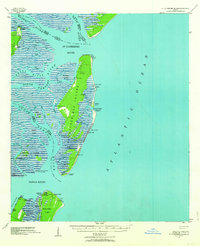
 1928 St Catherines Island1928 Print · USGSCoastal Georgia's intricate barrier islands and marshes are captured here in the early twentieth century. Genealogists and historians can locate specific sites like Bakers House & Chimney, the Quarantine Stack, and Harris.
 - 1942 Map of Meldrim
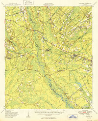
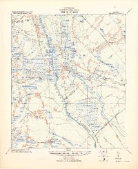 1942 Meldrim1942 Print · USGSThe Ogeechee River corridor and its railway junctions are captured here in a series of surveys finalized just before the mid-century. Researchers can trace the layout of early settlements like Meldrim and Ellabel or locate ancestral sites at Miller Chapel and Zion Church.
 - 1942 Map of Savannah
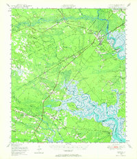
 1942 Savannah1942 Print · USGSCoastal Georgia and the South Carolina borderlands come alive in this wartime survey of the Savannah riverfront. Genealogists and historians can trace industrial housing at Port Wentworth Colored Village, river landmarks like Fort Jackson, and the footprint of the Ogeechee Canal.
 - 1943 Map of St Catherines Island, 1963 Print
 1943 St Catherines Island1963 Print · USGSCoastal Liberty County is seen here during the Second World War, showing the detailed shoreline from Ossabaw Island to Sapelo Island. Researchers can find landmark homesteads like Bakers House N Chimney and maritime sites including the Quarantine Flagstaff.2 unique versions available
 - 1944 Map of Limerick, 1945 Print
 1944 Limerick1945 Print · USGSCoastal Georgia during the mid-forties reveals a landscape transitioning between established agricultural settlements and expanding military grounds. Genealogists and researchers can trace local families through many Art Well locations and historic community centers like Midway Ch, Limerick, and Riceboro.
 - 1944 Map of Ossabaw Island, 1963 Print
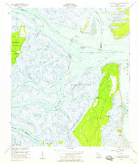
 1944 Ossabaw Island1963 Print · USGSCoastal Georgia's barrier islands and river networks come to life in this mid-century survey of the Ogeechee and Skidaway basins. Researchers can locate historical sites like Fort McAllister, the Kilkenny Club, and the vanished Cheves Mill Chimney among the tidal marshes.
 - 1945 Map of St. Catherine's Island
 1945 St. Catherine's Island1945 Print · USGSThe Georgia coast remained a wild expanse of tidal rivers and barrier islands in the years following the war. Genealogists and researchers can trace family landmarks like Bakers House N Chimney and the strategic maritime infrastructure on Black Beard Island.
 - 1945 Map of Bluffton
 1945 Bluffton1945 Print · USGSThe Carolina Lowcountry and Georgia's sea islands appear here in the mid-forties, before modern bridges transformed the coast. Trace the early footprints of Bluffton and Spanish Wells, or locate maritime landmarks like Buckingham Ferry and the Oyster Packing Plant.
 - 1945 Map of Ossabaw Island
 1945 Ossabaw Island1945 Print · USGSThe Georgia coast at the end of the war is a complex world of tidal rivers and historic fortifications. Genealogists and local historians can trace family-named sites and landmarks like Cheves Mill Chimney, Adams Chimney, and the Kilkenny Club among the winding creeks.
 - 1945 Map of Wassaw Sound
 1945 Wassaw Sound1945 Print · USGSThe Georgia coast near Savannah comes alive in this mid-century survey of the barrier islands and tidal sounds. Genealogists and historians can trace the early layout of Savannah Beach or the pristine reaches of Wassaw Island and Petit Chou Island.
 - 1946 Map of Brunswick, 1948 Print
 1946 Brunswick1948 Print · USGSCoastal Georgia in the mid-forties reveals a landscape defined by the Camp Stewart Military Reservation and the sprawling barrier islands. Genealogists and historians can trace the rail-and-river network through inland towns like Ludowici and Jesup, or locate coastal landmarks like the St Simon Light.
 - 1947 Map of Savannah
 1947 Savannah1947 Print · USGSCoastal Georgia and South Carolina are captured here in the mid-forties, showing the rail-and-river networks of the Lowcountry. Genealogists and researchers can trace old crossroads and river towns from Statesboro to Beaufort, alongside military sites like Camp Stewart and Parris Island.
 - 1948 Map of Brunswick
 1948 Brunswick1948 Print · USGSCoastal Georgia in the late 1940s is defined here by its labyrinthine barrier islands and the massive footprint of Camp Stewart. Genealogists and historians can trace the rail-tied growth of Jesup and Hinesville or locate coastal landmarks like St Simon Light.
 - 1948 Map of Savannah
 1948 Savannah1948 Print · USGSThe Georgia and South Carolina Lowcountry comes alive in this post-war survey of the coast and its river-fed hinterlands. Genealogists and historians can trace rail lines like the Central of Georgia RR and find established settlements such as Isle of Hope and Sylvania.
 - 1948 Map of Limerick, 1964 Print
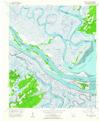
 1948 Limerick1964 Print · USGSCoastal Georgia's river-fed landscapes are captured here just after the war, showing the deep-rooted settlements of Liberty and Bryan counties. Genealogists can locate family sites among numerous landmarks like Dorchester Academy, Fort Morris, and the Old Dorchester Cem.
 - 1950 Map of Meldrim
 1950 Meldrim1950 Print · USGSCoastal Georgia in the late forties is defined by the rail lines and river swamps that connect inland towns like Meldrim and Blitchton. Genealogists can trace family landmarks and rural life at the Scaffletown School, Bethesda Ch, and Blitch Cem.2 unique versions available
 - 1950 Map of Limerick
 1950 Limerick1950 Print · USGSThe Georgia lowcountry at the mid-century mark shows a transition from coastal plantations to military and industrial expansion. Genealogists and historians can trace family roots through numerous sites like Dorchester Academy, Sunbury, and Scratchy Hall Cem.2 unique versions available
 - 1954 Map of St Catherines Sound, 1958 Print
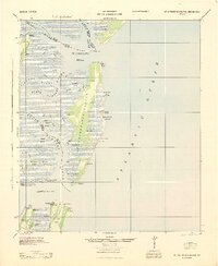
 1954 St Catherines Sound1958 Print · USGSCoastal Georgia's intricate salt marshes and barrier islands are captured in the mid-1950s, showing a landscape defined by tidal rivers and the Intracostal Waterway. You can trace old landing sites and local infrastructure like the Yellow Bluff Fishing Camp, Youmans Landing Field, and several island Artesian Wells.2 unique versions available
 - 1955 Map of Savannah Beach North, 1956 Print
 1955 Savannah Beach North1956 Print · USGSThe coastal border of South Carolina and Georgia comes alive in the mid-1950s, detailing the shifting sands and maritime defenses of the Atlantic coast. Researchers can trace the military grounds of Fort Screven or locate the historic Tybee Lighthouse and the small Cem on Tybee Island.3 unique versions available
 - 1955 Map of Garden City, 1957 Print
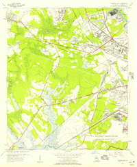 1955 Garden City1957 Print · USGSGarden City and the western outskirts of Savannah are shown here during a period of rapid aviation and rail expansion in the mid-fifties. Genealogists and historians can locate family landmarks like Silk Hope, the Lincoln Memorial Cem, and early recreational sites such as the Oglethorpe Speedway.2 unique versions available
 - 1955 Map of Fort Pulaski, 1957 Print
 1955 Fort Pulaski1957 Print · USGSCoastal South Carolina and Georgia meet at the mouth of the Savannah River in the mid-fifties, where salt marshes and tidal islands define the border. Researchers can trace historic family sites on Daufuskie Island like Mary Field Cem or locate the Lighthouse (Abandoned) near Fort Pulaski.2 unique versions available
Showing maps 1-25 of 159
Top cities of Chatham County
- Savannah historical maps
- Pooler historical maps
- Wilmington Island historical maps
- Georgetown historical maps
- Garden City historical maps
- Port Wentworth historical maps
See more
Frequently asked questions
- What are the different types of historical maps available for Chatham County?
- What is the oldest map of Chatham County?
- Where can I purchase historical maps of Chatham County for my home or office?
- Where can I download high-res historical maps of Chatham County?
- Are there historical topographic maps available for Chatham County?
- Is there historical aerial imagery available for Chatham County?
- Where are historical maps of Chatham County sourced from?