1970s Maps of Chatham County, Georgia
Explore 12 historic maps of Chatham County from the 1970s. These maps offer a rare glimpse into what life looked like during the 1970s — showing old roads, neighborhoods, homes, and landmarks that have changed or disappeared over time.
Whether you're researching your family's past, planning a metal detecting trip, or studying how Chatham County's landscape evolved across the 1970s, these high-resolution maps are a powerful tool for exploring the history of this region.
- Focus on a specific era: All maps on this page are from the 1970s, giving you a focused view of this time period.
- See what’s changed: Compare century-old streets, trails, and buildings to today's modern landscape using overlays and satellite layers.
- Research with precision: Use these maps for genealogy, historical research, land use analysis, or educational projects.
- View, download, or print: Maps are fully viewable online in high resolution, and can be downloaded or printed for your own records.
Start exploring Chatham County's history through authentic maps from the 1970s. This is your window into the past.
Chatham County, GA maps
(12)- 1978 Map of Tybee Island North
 1978 Tybee Island North1978 Print · USGSThe Georgia and South Carolina coastlines meet in the late seventies at the mouth of the Savannah River. Maritime historians and coastal researchers can trace the historic fortifications at Fort Screven and the shifting shoals around Bloody Pt and Tybee Knoll Spit.
 - 1978 Map of Fort Pulaski
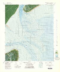
 1978 Fort Pulaski1978 Print · USGSThe coastal borderlands of Georgia and South Carolina are captured here in the late seventies, showing the tidal marshes where the Savannah River meets the sea. Researchers can trace the Old Railroad Grade and locate historic markers like Daufuskie Landing and Fort Pulaski National Monument.2 unique versions available
 - 1978 Map of Wassaw Sound
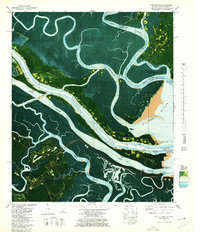
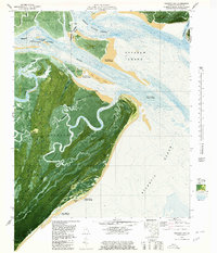
 1978 Wassaw Sound1978 Print · USGSThe Georgia coast in the late seventies is revealed through this hybrid aerial and topographic study of the marshes and barrier islands. Researchers can trace the tidal reaches of the Wilmington River or locate landmarks like Dead Man Hammock and Fort Pulaski National Monument.
 - 1978 Map of Beaufort
 1978 Beaufort1978 Print · USGSCoastal South Carolina and Georgia come to life in this detailed bathymetric study from the late seventies, featuring the intricate Sea Islands and the Savannah River mouth. Researchers can trace military history at Parris Island or locate inland settlements like Switzerland and Old Sheldon.2 unique versions available
 - 1978 Map of Savannah
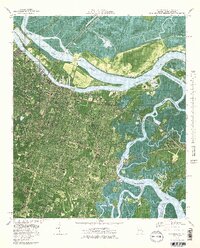 1978 Savannah1978 Print · USGSCoastal Georgia in the late seventies is captured here at the intersection of maritime industry and suburban growth. Genealogists and historians can trace neighborhood developments like Highland Park or locate burials at Hillcrest Cemetery and Forest Lawn Memory Gardens.3 unique versions available
 - 1978 Map of Brunswick
 1978 Brunswick1978 Print · USGSThe Georgia coast and its barrier islands are captured in the late 1970s, as I-95 and the rail lines shaped the growth of coastal towns. Genealogists and historians can trace family locations across the islands or locate sites near Fort Stewart, Darien, and Ludowici.2 unique versions available
 - 1979 Map of Burroughs
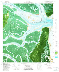
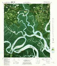 1979 Burroughs1979 Print · USGSThe marshes of Chatham County are captured in the late seventies as suburban growth begins to meet the coastal wetlands. Trace family roots at Wild Horn Cem and Hawkins Chapel, or explore the winding banks of the Little Ogeechee River near Vernonburg.4 unique versions available
 - 1979 Map of Tybee Island South
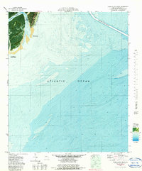 1979 Tybee Island South1979 Print · USGSTybee Island and the Georgia coast are captured here in the late seventies during a period of active shoreline management. Researchers can trace the Beach Renourished 1976 zone and locate coastal settlements like Spanish Hammock and South End.2 unique versions available
 - 1979 Map of Oak Level
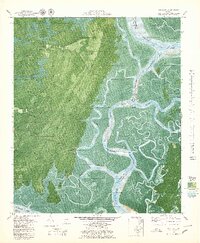 1979 Oak Level1979 Print · USGSCoastal Bryan County in the late seventies reveals a landscape of tidal marshes and historic riverside landings. Researchers can trace family sites near Kilkenny, locate the Cem off Fancy Hall Road, and navigate the complex bends of the Bear River and Florida Passage Intracoastal Waterway.3 unique versions available
 - 1979 Map of Isle of Hope
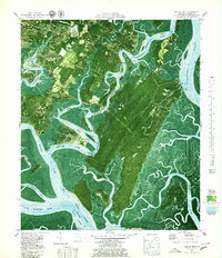 1979 Isle of Hope1979 Print · USGSThe Georgia coastline near Savannah underwent notable residential and ecological shifts in the late seventies. Genealogists and historians can trace family locations through sites like Sandfly Bakers Crossing, Old Church Cem, and the Bethesda Home for Boys.3 unique versions available
 - 1979 Map of Raccoon Key, 1980 Print
 1979 Raccoon Key1980 Print · USGSCoastal Georgia's barrier islands and tidal marshes are captured in the late seventies, showing the primitive road networks and isolated landings of Ossabaw Island. Researchers can trace the winding Cabbage River and locate historic sites like Torreys Landing and Middle Place.2 unique versions available
 - 1979 Map of St Catherines Sound, 1980 Print
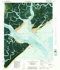
 1979 St Catherines Sound1980 Print · USGSCoastal Georgia's barrier islands and intricate marshes are captured here in the late seventies. Genealogists and local historians can locate Yellow Bluff Fishing Camp, the solitary Cem Grave on St Catherines Island, and the boundaries of Harris Neck National Wildlife Refuge.2 unique versions available
End of results
Showing maps 1-12 of 12
Top cities of Chatham County
- Savannah historical maps
- Pooler historical maps
- Wilmington Island historical maps
- Georgetown historical maps
- Garden City historical maps
- Port Wentworth historical maps
See more
Frequently asked questions
- What are the different types of historical maps available for Chatham County?
- What is the oldest map of Chatham County?
- Where can I purchase historical maps of Chatham County for my home or office?
- Where can I download high-res historical maps of Chatham County?
- Are there historical topographic maps available for Chatham County?
- Is there historical aerial imagery available for Chatham County?
- Where are historical maps of Chatham County sourced from?