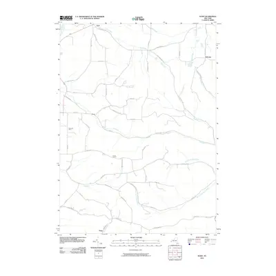
2010 Map of Ivory
USGS Topo · Published 2010About this map
Ivory and the surrounding Chautauqua County countryside are defined by a complex network of waterways that once powered local industry and agriculture. Tributaries such as Mud Creek, Frews Run, and Cass Run carve through the landscape, alongside the larger Conewango Creek in the northwest corner. This 2010 survey reveals a community of long-standing hamlets, including Clark, Vollentine, and Dodge, connected by a web of rural roads named for early settler families, such as Scott Rd, Swanson Hill Rd, and Guernsey Rd. The presence of the Oak Hill Cemetery and the Kostfamily Apiary reflects the area's continued reliance on the land. In the eastern portion of the sheet, multiple branches of Sawmill Run and Little Bone Run indicate the historic importance of timber and water-driven mills in this corner of New York.
Find a feature on this map
55 named features on this map. Tap any name to fly to it.
Don’t see what you’re looking for? This feature index may not catch every label — zoom into the map to look around manually.
Map Details
Editions of this 2010 Ivory Map
This is the sole edition of this map. No revisions or reprints were ever made.
Other maps of this area

1905 · Jamestown
USGS Topo · 1:62,500

1906 · Warren
USGS Topo · 1:62,500

1907 · Warren
USGS Topo · 1:62,500

1908 · Warren
USGS Topo · 1:62,500

1922 · Randolph
USGS Topo · 1:62,500

1923 · Randolph
USGS Topo · 1:62,500

1936 · Kinzua
USGS Topo · 1:48,000

1941 · Kinzua
USGS Topo · 1:62,500

1942 · Jamestown
USGS Topo · 1:62,500

1943 · Randolph
USGS Topo · 1:62,500