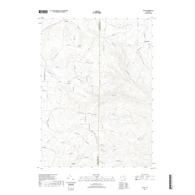
2019 Map of Ivory
USGS Topo · Published 2019About this map
Ivory and the surrounding uplands of the Chautauqua and Cattaraugus border define this landscape of deeply carved runs and ridges. The terrain is marked by a network of drainage ways including Cass Run, Bone Run, and the N Br Sawmill Run, which have shaped the local settlement patterns. Small hamlets and crossroads like Vollentine, Clark, and Dodge are connected by a web of rural routes such as Frewsburg-Kennedy Rd and Coldspring Rd.
Find a feature on this map
71 named features on this map. Tap any name to fly to it.
Don’t see what you’re looking for? This feature index may not catch every label — zoom into the map to look around manually.
Map Details
Editions of this 2019 Ivory Map
This is the sole edition of this map. No revisions or reprints were ever made.
Other maps of this area

1905 · Jamestown
USGS Topo · 1:62,500

1906 · Warren
USGS Topo · 1:62,500

1907 · Warren
USGS Topo · 1:62,500

1908 · Warren
USGS Topo · 1:62,500

1922 · Randolph
USGS Topo · 1:62,500

1923 · Randolph
USGS Topo · 1:62,500

1936 · Kinzua
USGS Topo · 1:48,000

1941 · Kinzua
USGS Topo · 1:62,500

1942 · Jamestown
USGS Topo · 1:62,500

1943 · Randolph
USGS Topo · 1:62,500