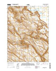
2014 Map of Jackass Butte
USGS Topo · Published 2014About this map
Jackass Mountain and the adjacent Jackass Butte dominate this section of the High Desert, rising above the southeastern edge of the Harney Basin. The landscape is defined by its water management systems, notably the Buena Vista Canal which cuts through the Blitzen Valley to reach Buena Vista Lake. This network reflects the complex relationship between the arid terrain and the agricultural needs of the region in the early 21st century. High-clearance access routes like Jack Mountain Rd and the Jack Mountain Spur traverse the heights, while the Black Rim escarpment provides a sharp geographical boundary to the west. The presence of Or-205 along the eastern edge of the valley floor serves as the primary artery connecting these remote landforms.
Find a feature on this map
14 named features on this map. Tap any name to fly to it.
Don’t see what you’re looking for? This feature index may not catch every label — zoom into the map to look around manually.
Map Details
Editions of this 2014 Jackass Butte Map
This is the sole edition of this map. No revisions or reprints were ever made.
Other maps of this area

1955 · Burns
USGS Topo · 1:250,000

1955 · Adel
USGS Topo · 1:250,000

1957 · Adel
USGS Topo · 1:250,000

1958 · Burns
USGS Topo · 1:250,000

1958 · Adel
USGS Topo · 1:250,000

1959 · Burns
USGS Topo · 1:250,000

1962 · Adel
USGS Topo · 1:250,000

1967 · Coyote Buttes
USGS Topo · 1:24,000

1967 · Krumbo Reservoir
USGS Topo · 1:24,000

1967 · Jackass Butte
USGS Topo · 1:24,000