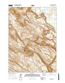
2017 Map of Jackass Butte
USGS Topo · Published 2017About this map
Jackass Mountain and its nearby namesake, Jackass Butte, dominate this high-desert landscape in Harney County. This 2017 survey details the complex hydrologic features of the Blitzen Valley, where the Buena Vista Canal and Buena Vista Lake define the eastern lowlands. The terrain rises sharply to the west, marked by the prominent volcanic profile of Black Rim. The network of local routes, including Jack Mountain Rd and Boulder Res Rd, reveals how the area is navigated for land management and ranching. The map preserves the exact alignment of these desert roads and water management features, providing an essential record for those studying the contemporary geography and water rights history of this part of the Oregon high desert.
Find a feature on this map
15 named features on this map. Tap any name to fly to it.
Don’t see what you’re looking for? This feature index may not catch every label — zoom into the map to look around manually.
Map Details
Editions of this 2017 Jackass Butte Map
This is the sole edition of this map. No revisions or reprints were ever made.
Other maps of this area

1955 · Burns
USGS Topo · 1:250,000

1955 · Adel
USGS Topo · 1:250,000

1957 · Adel
USGS Topo · 1:250,000

1958 · Burns
USGS Topo · 1:250,000

1958 · Adel
USGS Topo · 1:250,000

1959 · Burns
USGS Topo · 1:250,000

1962 · Adel
USGS Topo · 1:250,000

1967 · Coyote Buttes
USGS Topo · 1:24,000

1967 · Krumbo Reservoir
USGS Topo · 1:24,000

1967 · Jackass Butte
USGS Topo · 1:24,000