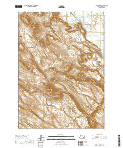
2020 Map of Jackass Butte
USGS Topo · Published 2020About this map
Jackass Butte and Jackass Mtn dominate this high-desert landscape in Harney County, illustrating the dramatic topography of southeastern Oregon's basin and range province. The eastern portion of the survey is defined by the Blitzen Valley, where the Buena Vista Canal cuts through the lowlands, representing the vital water management systems essential to the region's ranching history. To the west, the prominent cliff face of Black Rim overlooks a series of draws and ridges, with only W Rockford Ln and a network of unimproved roads providing access through the varied elevation. This 2020 edition provides a clear record of the persistent landforms and drainage patterns that have shaped land use in this isolated corridor for generations.
Find a feature on this map
6 named features on this map. Tap any name to fly to it.
Don’t see what you’re looking for? This feature index may not catch every label — zoom into the map to look around manually.
Map Details
Editions of this 2020 Jackass Butte Map
This is the sole edition of this map. No revisions or reprints were ever made.
Other maps of this area

1955 · Burns
USGS Topo · 1:250,000

1955 · Adel
USGS Topo · 1:250,000

1957 · Adel
USGS Topo · 1:250,000

1958 · Burns
USGS Topo · 1:250,000

1958 · Adel
USGS Topo · 1:250,000

1959 · Burns
USGS Topo · 1:250,000

1962 · Adel
USGS Topo · 1:250,000

1967 · Coyote Buttes
USGS Topo · 1:24,000

1967 · Krumbo Reservoir
USGS Topo · 1:24,000

1967 · Jackass Butte
USGS Topo · 1:24,000