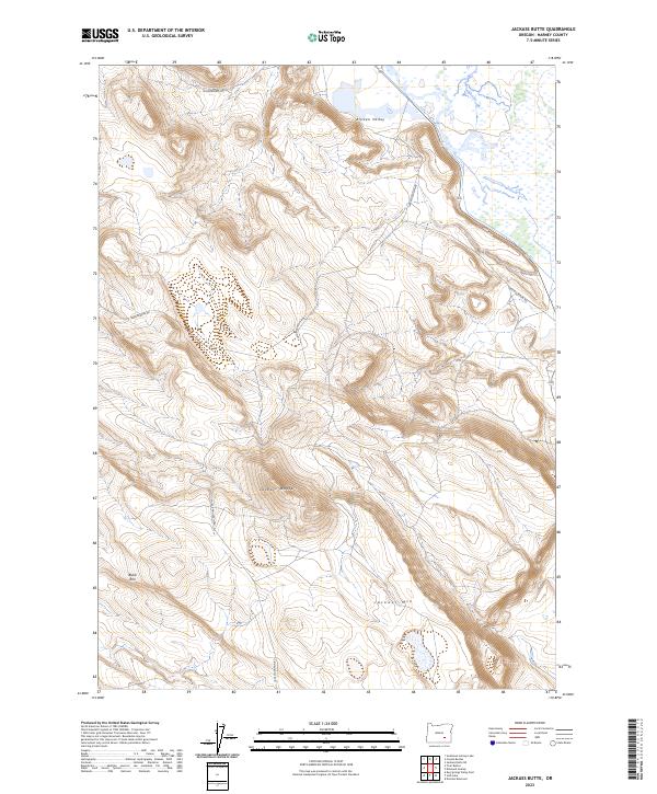
2023 Map of Jackass Butte
USGS Topo · Published 2023About this map
The Malheur National Wildlife Refuge marks the northeastern edge of this Harney County landscape, where the marshy lowlands meet the high desert plateau. This area is defined by sharp topographic transitions, particularly the Blitzen Valley corridor that provides a critical water source in an otherwise arid environment. The terrain rises sharply to the west, dominated by prominent volcanic features like Jackass Butte and the long, dark escarpment of Black Rim. A sparse network of primitive routes, including Jack Mountain Rd and Boulder Res Rd, traces the contours of the basin and range province. These roads likely serve the historic cattle ranching operations that have long shaped the cultural landscape of southeastern Oregon. The map illustrates the isolation and scale of the region, where settlement is represented more by land management boundaries and remote tracks than by towns or centers.
Find a feature on this map
12 named features on this map. Tap any name to fly to it.
Don’t see what you’re looking for? This feature index may not catch every label — zoom into the map to look around manually.
Map Details
Editions of this 2023 Jackass Butte Map
This is the sole edition of this map. No revisions or reprints were ever made.
Other maps of this area

1955 · Burns
USGS Topo · 1:250,000

1955 · Adel
USGS Topo · 1:250,000

1957 · Adel
USGS Topo · 1:250,000

1958 · Burns
USGS Topo · 1:250,000

1958 · Adel
USGS Topo · 1:250,000

1959 · Burns
USGS Topo · 1:250,000

1962 · Adel
USGS Topo · 1:250,000

1967 · Coyote Buttes
USGS Topo · 1:24,000

1967 · Krumbo Reservoir
USGS Topo · 1:24,000

1967 · Jackass Butte
USGS Topo · 1:24,000