2024 Map of Jacksonboro
USGS Topo · Published 2024About this map
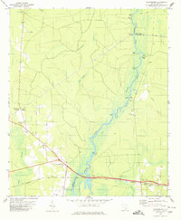
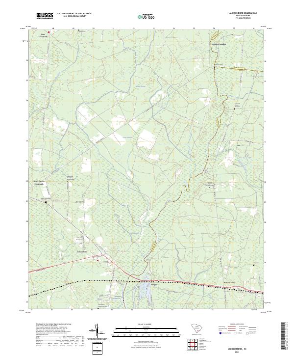
Jacksonboro and its surrounding Lowcountry landscape are defined by the winding course of the Edisto River and a dense network of historically significant burial grounds and crossroads. The presence of sites like the Hayne Hall Plantation Burial Ground and the Bethel Presbyterian Church Graveyard speaks to the deep colonial and antebellum roots of this region. The landscape transitions from the open expanses of Green Meadow and Burden Swamp to small, named clusters such as Burnt Church Crossroads and Iron Crossroads. Transport patterns are marked by old river connections at Parkers Ferry and Lowndes Landing, while the modern corridor of Ace Basin Pkwy intersects the more established routes of Old Jacksonboro Rd. This survey documents a quiet rural area where family and community landmarks, such as Buzzard Roost Cem and the Jacksonboro Community Cem, remain integral to the geographical identity of Colleton County.
Find a feature on this map
52 named features on this map. Tap any name to fly to it.
Don’t see what you’re looking for? This feature index may not catch every label — zoom into the map to look around manually.
Map Details
Editions of this 2024 Jacksonboro Map
This is the sole edition of this map. No revisions or reprints were ever made.