2022 Map of Jacksonville
USGS Topo · Published 2022About this map
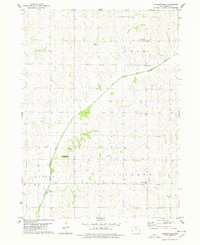
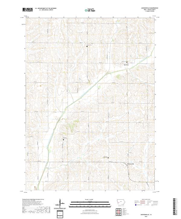
Jacksonville and the small settlement of Red Line anchor this detailed study of eastern Shelby County. The landscape is defined by the winding course of the East Branch West Nishnabotna River, which cuts diagonally across the terrain, joined by tributaries such as Bonnie Cr and Wolf Cr. This map is particularly valuable for genealogical research, as it identifies several localized burial grounds that serve as landmarks for early family history in the township, including Danway Cem, Bowmans Grove Cem, and Bethlehem Lutheran Cem. The rural road network, organized into a rigid grid of numbered streets and named routes like Redwood Rd and Timber Rd, reflects the enduring agrarian structure of this part of Iowa. Local landmarks such as the Red Line Cem and the creek-fed valleys provide a precise view of the community's physical and historical geography.
Find a feature on this map
42 named features on this map. Tap any name to fly to it.
Don’t see what you’re looking for? This feature index may not catch every label — zoom into the map to look around manually.
Map Details
Editions of this 2022 Jacksonville Map
This is the sole edition of this map. No revisions or reprints were ever made.