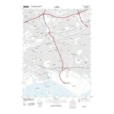
2010 Map of Jamaica
USGS Topo · Published 2010About this map
Jamaica and its surrounding Queens neighborhoods are shown in extensive detail at the beginning of the 21st century, revealing a landscape defined by dense urban residential blocks, major transportation arteries, and significant green spaces. The map illustrates the complex infrastructure of the borough, from the sprawling John F Kennedy International Airport in the south to the institutional campuses of the City University of New York Queens College and Saint John's University Queens Campus. Historical burial grounds like Saint Johns Cemetery and Prospect Cemetery provide open space among the tightly packed street grids of Forest Hills Gardens and Richmond Hill.
Find a feature on this map
114 named features on this map. Tap any name to fly to it.
Don’t see what you’re looking for? This feature index may not catch every label — zoom into the map to look around manually.
Map Details
Editions of this 2010 Jamaica Map
This is the sole edition of this map. No revisions or reprints were ever made.
Other maps of this area

1889 · Brooklyn
USGS Topo · 1:62,500

1891 · Brooklyn
USGS Topo · 1:62,500

1891 · Harlem
USGS Topo · 1:62,500

1897 · Harlem
USGS Topo · 1:62,500

1897 · Brooklyn
USGS Topo · 1:62,500

1897 · Hempstead
USGS Topo · 1:62,500

1897 · Oyster Bay
USGS Topo · 1:62,500

1898 · Harlem
USGS Topo · 1:62,500

1898 · Hempstead
USGS Topo · 1:62,500

1898 · Brooklyn
USGS Topo · 1:62,500