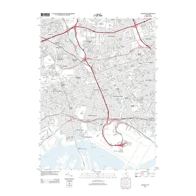
2013 Map of Jamaica
USGS Topo · Published 2013About this map
The dense urban grid of Queens dominates this 2013 topographic study, illustrating the complex intersection of residential neighborhoods and major transit hubs. From the extensive grounds of John F Kennedy International Airport in the south to the sporting landmarks of Arthur Ashe Stadium in the north, the landscape is a portrait of modern infrastructure. The map reveals the intricate network of the Van Wyck Expy and Belt Pkwy as they weave through established communities like Jamaica and Forest Hills. Notable green spaces and water bodies, including Meadow Lake and Willow Lake, provide relief from the surrounding density, while historic sites such as Cypress Hills Cem and Bayside Cem anchor the area's local history. The presence of the Aqueduct Racetrack and Queens College further highlights the varied institutional character of this central New York borough.
Find a feature on this map
84 named features on this map. Tap any name to fly to it.
Don’t see what you’re looking for? This feature index may not catch every label — zoom into the map to look around manually.
Map Details
Editions of this 2013 Jamaica Map
This is the sole edition of this map. No revisions or reprints were ever made.
Other maps of this area

1889 · Brooklyn
USGS Topo · 1:62,500

1891 · Brooklyn
USGS Topo · 1:62,500

1891 · Harlem
USGS Topo · 1:62,500

1897 · Harlem
USGS Topo · 1:62,500

1897 · Brooklyn
USGS Topo · 1:62,500

1897 · Hempstead
USGS Topo · 1:62,500

1897 · Oyster Bay
USGS Topo · 1:62,500

1898 · Harlem
USGS Topo · 1:62,500

1898 · Hempstead
USGS Topo · 1:62,500

1898 · Brooklyn
USGS Topo · 1:62,500