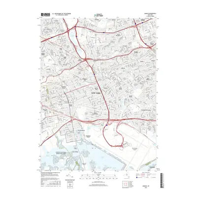
2016 Map of Jamaica
USGS Topo · Published 2016About this map
Jamaica Bay dominates the southern edge of this urban landscape, where the tidal wetlands of Elders Point Marsh and Duck Point Marshes contrast sharply with the industrial footprint of John F Kennedy International Airport. The interior of the borough reveals a dense network of neighborhoods defined by major arterial expressways, including the Van Wyck Expy E and the Grand Central Pkwy. Large institutional and green spaces punctuate the grid, such as Cuny Queens Coll and a significant cluster of historic burial grounds like Maple Grove Cem and Saint Johns Cem. This topography captures the modern infrastructure of Queens, from the aviation hub at Bergen Basin to the residential streets of Richmond Hill and Forest Hills, illustrating how transport corridors have shaped the development of these historic New York communities.
Find a feature on this map
82 named features on this map. Tap any name to fly to it.
Don’t see what you’re looking for? This feature index may not catch every label — zoom into the map to look around manually.
Map Details
Editions of this 2016 Jamaica Map
This is the sole edition of this map. No revisions or reprints were ever made.
Other maps of this area

1889 · Brooklyn
USGS Topo · 1:62,500

1891 · Brooklyn
USGS Topo · 1:62,500

1891 · Harlem
USGS Topo · 1:62,500

1897 · Harlem
USGS Topo · 1:62,500

1897 · Brooklyn
USGS Topo · 1:62,500

1897 · Hempstead
USGS Topo · 1:62,500

1897 · Oyster Bay
USGS Topo · 1:62,500

1898 · Harlem
USGS Topo · 1:62,500

1898 · Hempstead
USGS Topo · 1:62,500

1898 · Brooklyn
USGS Topo · 1:62,500