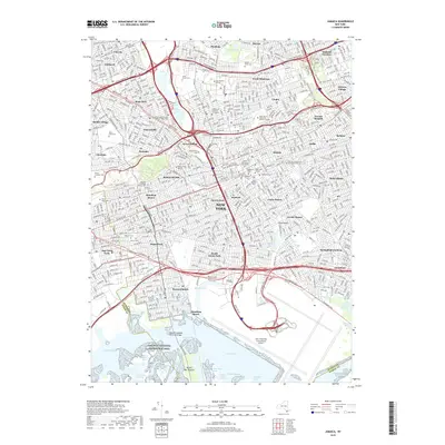
2019 Map of Jamaica
USGS Topo · Published 2019About this map
Jamaica and its surrounding neighborhoods are depicted in extensive detail, showcasing a dense urban grid intersected by a complex network of major expressways. The landscape is defined by the massive footprint of the John F Kennedy International Airport to the south and the sprawling Gateway National Recreation Area across the tidal marshes of Jamaica Bay. This survey illustrates the intricate balance between residential communities like Forest Hills, Ozone Park, and Queens Village and the significant institutional presence of schools such as Cuny Queens College and Saint John's University Queens Campus. Numerous historical burying grounds, including the Wyckoff-Snediker Family Cem and Grace Episcopal Churchyard, remain as quiet witnesses to the area's long history within the modern metropolitan sprawl. Heavy transit arteries like the Van Wyck Expy and Long Island railroad lines dictate the flow of the modern borough.
Find a feature on this map
94 named features on this map. Tap any name to fly to it.
Don’t see what you’re looking for? This feature index may not catch every label — zoom into the map to look around manually.
Map Details
Editions of this 2019 Jamaica Map
This is the sole edition of this map. No revisions or reprints were ever made.
Other maps of this area

1889 · Brooklyn
USGS Topo · 1:62,500

1891 · Brooklyn
USGS Topo · 1:62,500

1891 · Harlem
USGS Topo · 1:62,500

1897 · Harlem
USGS Topo · 1:62,500

1897 · Brooklyn
USGS Topo · 1:62,500

1897 · Hempstead
USGS Topo · 1:62,500

1897 · Oyster Bay
USGS Topo · 1:62,500

1898 · Harlem
USGS Topo · 1:62,500

1898 · Hempstead
USGS Topo · 1:62,500

1898 · Brooklyn
USGS Topo · 1:62,500