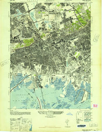
1947 Map of Jamaica
USGS Topo · Published 1947About this map
The dense grid of Jamaica and its surrounding boroughs of Queens and Brooklyn dominates this mid-century view. Large institutional and recreational grounds interrupt the urban sprawl, including the Aqueduct Race Track and Jamaica Race Track, alongside sprawling memorial sites like Maple Grove Cemetery and St Johns Cem. The landscape reflects a period of massive infrastructure growth, with the Van Wyck Expressway under construction and a network of arterial roads like the Grand Central Parkway and Southern Parkway carving through established neighborhoods like Forest Hills and Kew Gardens.
Find a feature on this map
80 named features on this map. Tap any name to fly to it.
Don’t see what you’re looking for? This feature index may not catch every label — zoom into the map to look around manually.
Map Details
Editions of this 1947 Jamaica Map
This is the sole edition of this map. No revisions or reprints were ever made.
Other maps of this area

1889 · Brooklyn
USGS Topo · 1:62,500

1891 · Brooklyn
USGS Topo · 1:62,500

1891 · Harlem
USGS Topo · 1:62,500

1897 · Harlem
USGS Topo · 1:62,500

1897 · Brooklyn
USGS Topo · 1:62,500

1897 · Hempstead
USGS Topo · 1:62,500

1897 · Oyster Bay
USGS Topo · 1:62,500

1898 · Harlem
USGS Topo · 1:62,500

1898 · Hempstead
USGS Topo · 1:62,500

1898 · Brooklyn
USGS Topo · 1:62,500