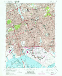
1979 Map of Jamaica
USGS Topo · Published 1979About this map
The dense residential and industrial landscapes of central and southeastern Queens are meticulously documented here following late-1970s revisions. This survey highlights the critical transportation hubs of the era, dominated by the massive footprint of John F Kennedy International Airport and the intricate tracks of the Long Island Rail Road weaving through established neighborhoods like Richmond Hill and Queens Village. Significant institutional landmarks are scattered throughout the urban grid, including St Johns University, Queens College, and large medical complexes such as the St Albans Naval Hospital.
Find a feature on this map
102 named features on this map. Tap any name to fly to it.
Don’t see what you’re looking for? This feature index may not catch every label — zoom into the map to look around manually.
Map Details
Editions of this 1979 Jamaica Map
This is the sole edition of this map. No revisions or reprints were ever made.
Other maps of this area

1889 · Brooklyn
USGS Topo · 1:62,500

1891 · Brooklyn
USGS Topo · 1:62,500

1891 · Harlem
USGS Topo · 1:62,500

1897 · Harlem
USGS Topo · 1:62,500

1897 · Brooklyn
USGS Topo · 1:62,500

1897 · Hempstead
USGS Topo · 1:62,500

1897 · Oyster Bay
USGS Topo · 1:62,500

1898 · Harlem
USGS Topo · 1:62,500

1898 · Hempstead
USGS Topo · 1:62,500

1898 · Brooklyn
USGS Topo · 1:62,500