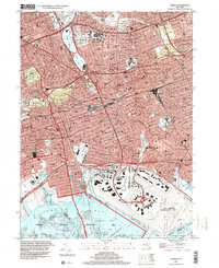
1994 Map of Jamaica
USGS Topo · Published 2000About this map
Jamaica serves as a dense urban hub in this late-century snapshot of central Queens, where the industrial and residential grid meets the expansive shoreline of Jamaica Bay. The landscape is defined by its massive infrastructure, dominated by the footprint of John F Kennedy International Airport in the southeast and the crisscrossing tracks of the Long Island Rail Road. Educational and civic anchors like Queens College, St Johns University, and Queens Borough Hall sit amidst established neighborhoods from Richmond Hill to Queens Village.
Find a feature on this map
101 named features on this map. Tap any name to fly to it.
Don’t see what you’re looking for? This feature index may not catch every label — zoom into the map to look around manually.
Map Details
Editions of this 1994 Jamaica Map
This is the sole edition of this map. No revisions or reprints were ever made.
Other maps of this area

1889 · Brooklyn
USGS Topo · 1:62,500

1891 · Brooklyn
USGS Topo · 1:62,500

1891 · Harlem
USGS Topo · 1:62,500

1897 · Harlem
USGS Topo · 1:62,500

1897 · Brooklyn
USGS Topo · 1:62,500

1897 · Hempstead
USGS Topo · 1:62,500

1897 · Oyster Bay
USGS Topo · 1:62,500

1898 · Harlem
USGS Topo · 1:62,500

1898 · Hempstead
USGS Topo · 1:62,500

1898 · Brooklyn
USGS Topo · 1:62,500