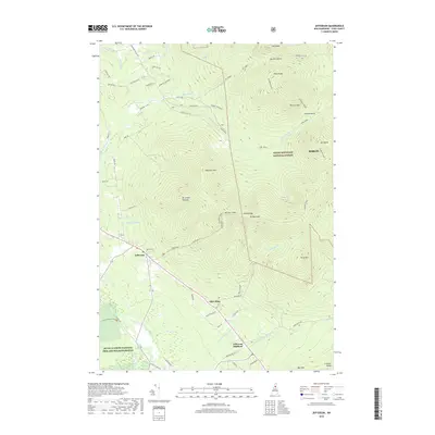
2018 Map of Jefferson
USGS Topo · Published 2018About this map
The mountain village of Jefferson and its neighboring hamlets of Starr King and Jefferson Highland sit at the foot of the Pliny Range in this northern Coos County survey. The landscape is dominated by the high peaks of the White Mountain National Forest, including Mt Waumbek and Mt Starr King. The Israel River and its numerous tributaries, such as Priscilla Brook and Stalbird Brook, drain the valleys between these massive formations. The map detail reflects the region's enduring character as a destination for outdoor recreation and timber, shown through the network of logging routes like Edward Logging Rd and the Starr King Trl. To the southwest, the Silvio O Conte National Fish and Wildlife Refuge protects the riparian corridor along the river as it flows toward the edge of Berlin.
Find a feature on this map
63 named features on this map. Tap any name to fly to it.
Don’t see what you’re looking for? This feature index may not catch every label — zoom into the map to look around manually.
Map Details
Editions of this 2018 Jefferson Map
This is the sole edition of this map. No revisions or reprints were ever made.
Other maps of this area

1893 · Mt. Washington
USGS Topo · 1:62,500

1896 · Mt. Washington
USGS Topo · 1:62,500

1900 · Whitefield
USGS Topo · 1:62,500

1920 · Guildhall
USGS Topo · 1:62,500

1930 · Percy
USGS Topo · 1:62,500

1931 · Guildhall
USGS Topo · 1:48,000

1933 · Guildhall
USGS Topo · 1:48,000

1934 · Percy
USGS Topo · 1:62,500

1935 · Whitefield
USGS Topo · 1:48,000

1935 · Mt. Washington
USGS Topo · 1:62,500