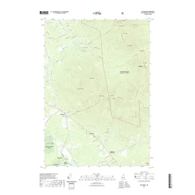
2021 Map of Jefferson
USGS Topo · Published 2021About this map
Jefferson and Jefferson Highland anchor the southwestern landscape of this Coos County survey, where the valley of the Israel River transitions into the high peaks of the White Mountain National Forest. This modern record detail the community clusters around Starr King and the historic burial grounds of Hillside Cem, Starr King Cem, and Forest Vale Cem. The map illustrates a complex network of recreational and logging access, from the Kilkenny Ridge Trl and Mt Cabot Trl to Edward Logging Rd. Rising above the valley, the Pliny Range and the Crescent Range dominate the topography, with significant summits including Mt Starr King, Mt Waumbek, and Mt Joseph Whipple. Extensive conservation lands are documented, including the Silvio O Conte NFWR, providing a clear view of how public and private lands intersect in northern New Hampshire.
Find a feature on this map
79 named features on this map. Tap any name to fly to it.
Don’t see what you’re looking for? This feature index may not catch every label — zoom into the map to look around manually.
Map Details
Editions of this 2021 Jefferson Map
This is the sole edition of this map. No revisions or reprints were ever made.
Other maps of this area

1893 · Mt. Washington
USGS Topo · 1:62,500

1896 · Mt. Washington
USGS Topo · 1:62,500

1900 · Whitefield
USGS Topo · 1:62,500

1920 · Guildhall
USGS Topo · 1:62,500

1930 · Percy
USGS Topo · 1:62,500

1931 · Guildhall
USGS Topo · 1:48,000

1933 · Guildhall
USGS Topo · 1:48,000

1934 · Percy
USGS Topo · 1:62,500

1935 · Whitefield
USGS Topo · 1:48,000

1935 · Mt. Washington
USGS Topo · 1:62,500