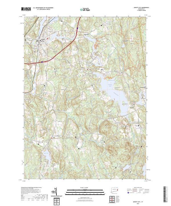
2024 Map of Jewett City
USGS Topo · Published 2024About this map
Jewett City serves as the primary hub where the Quinebaug River meets the Pachaug River, a landscape defined by its historical water-driven industry and deep-rooted community markers. The map reveals a high density of burial sites that trace family histories across the terrain, including the Old Kinne Burying Ground Cem, Jewett City Cem, and the Guiles - Safford Cemeteries. Small settlements like Glasgo, Pachaug, and Hopeville dot the region, separated by significant natural features such as Geer Hill and the sprawling Pachaug State Forest. The presence of the Grist Mill Pond near Doaneville and the Spruce Airport north of Pachaug Pond illustrates the diverse evolution of local infrastructure, from traditional milling sites to aviation. To the south, Amos Lake and the Cedar Swamp provide a clear view of the wetland systems that have historically influenced the growth of Preston City.
Find a feature on this map
197 named features on this map. Tap any name to fly to it.
Don’t see what you’re looking for? This feature index may not catch every label — zoom into the map to look around manually.
Map Details
Editions of this 2024 Jewett City Map
This is the sole edition of this map. No revisions or reprints were ever made.
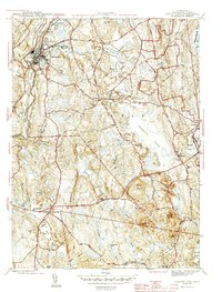
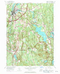
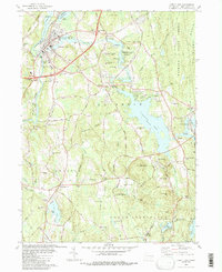
Historical Maps of Pachaug Through Time
4 maps found