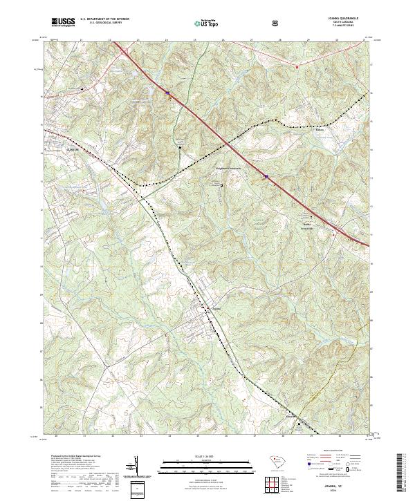
2024 Map of Joanna
USGS Topo · Published 2024About this map
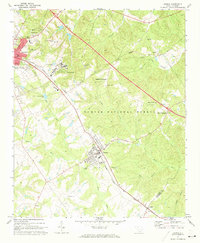
Joanna and the eastern edge of Clinton anchor this landscape where the Piedmont hills meet the expansive Sumter National Forest. The map documents a classic South Carolina upstate settlement pattern, with small rural centers like Neighbors Crossroads and Bonds Crossroads linked by a network of state roads and the presence of Railroad St. Genealogists will find significant value in the numerous well-documented burial grounds scattered across the terrain, including Hurricane Church Graveyard and Bethlehem Church Graveyard. In the northwest, the campus of Presbyterian College sits near the headwaters of Millers Fork, while the hydrology of the region is further defined by several managed water bodies such as Sarah Copeland Pond and the Duncan Cr WCD Lake Number Eight. The eastern reach of the quadrangle follows the drainage of Indian Creek and South Fork Duncan Creek through dense forest cover.
Find a feature on this map
118 named features on this map. Tap any name to fly to it.
Don’t see what you’re looking for? This feature index may not catch every label — zoom into the map to look around manually.
Map Details
Editions of this 2024 Joanna Map
This is the sole edition of this map. No revisions or reprints were ever made.