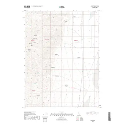
2018 Map of Job Peak
USGS Topo · Published 2018About this map
Stillwater Range peaks dominate this high-desert landscape, defined by the towering Job Peak and its surrounding network of canyons. The map tracks the sharp descent from the high ridges of Freeman Basin and Poco Canyon down into the broad expanse of Dixie Valley to the east. Historically critical water sources are scattered throughout this arid terrain, including Poco Camp Spring, Coyote Spring, and Coyote Canyon Spring, which supported early travelers and ranchers in the Great Basin. Modern access is represented by Dixie Valley Rd and Kyle Ln, skirting the edge of the Dixie Valley Wash. The complex drainages of Middle Fork Pete Canyon and South Fork Pete Canyon demonstrate the erosive force of seasonal runoff in this environment, while the proximity of various springs suggests the vital role of groundwater for survival in this portion of Churchill County.
Find a feature on this map
30 named features on this map. Tap any name to fly to it.
Don’t see what you’re looking for? This feature index may not catch every label — zoom into the map to look around manually.
Map Details
Editions of this 2018 Job Peak Map
This is the sole edition of this map. No revisions or reprints were ever made.
Other maps of this area

1908 · Carson Sink
USGS Topo · 1:250,000

1910 · Carson Sink
USGS Topo · 1:250,000

1957 · Reno
USGS Topo · 1:250,000

1959 · Reno
USGS Topo · 1:250,000

1960 · Reno
USGS Topo · 1:250,000

1969 · Cox Canyon
USGS Topo · 1:24,000

1969 · Table Mtn
USGS Topo · 1:24,000

1972 · Pirouette Mtn
USGS Topo · 1:24,000
1972 · I X L Canyon
USGS Topo · 1:24,000
1972 · Job Peak
USGS Topo · 1:24,000