Loading...
Loading map...2022 Map of Joes
USGS Topo · Published 2022About this map
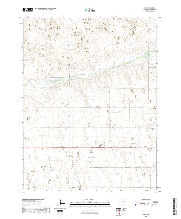
Joes serves as the primary settlement on this High Plains landscape, situated amidst a grid of section lines and county roads in eastern Colorado. The terrain is defined by the wandering course of the Arikaree River, which cuts a wide path through the prairie, creating a distinct riparian corridor through township lines like t4s r48w and t4s r47w.
Find a feature on this map
24 named features on this map. Tap any name to fly to it.
Don’t see what you’re looking for? This feature index may not catch every label — zoom into the map to look around manually.
Map Details
Date Portrayed2022
Date Published2022
PublisherU.S. Geological Survey
Map TypeTopographic
Scale1:24000
Physical Dimensions24 x 29 inches
Editions of this 2022 Joes Map
This is the sole edition of this map. No revisions or reprints were ever made.
Historical Maps of Joes Through Time
2 maps found
Featured Locations
Source Details
SourceU.S. Geological Survey
CopyrightPublic Domain