Loading...
Loading map...2024 Map of Johnston City
USGS Topo · Published 2024About this map
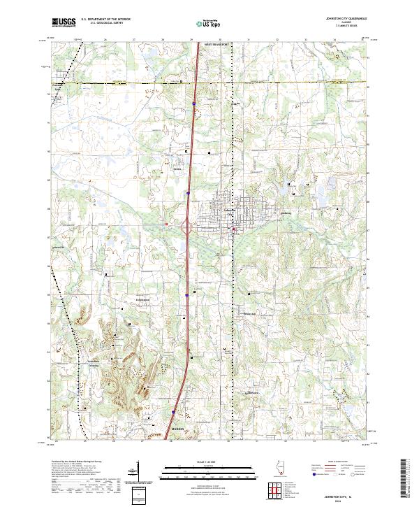
Johnston City serves as the central hub for this portion of Williamson County, where the dense grid of city streets meets the surrounding coal-country landscape. This modern survey shows a region defined by a high concentration of small family cemeteries and crossroads settlements, reflecting generations of rural history and local residency. To the north, Freeman Spur sits on the border with Franklin County, while the southern landscape transitions into the outskirts of Marion.
Find a feature on this map
153 named features on this map. Tap any name to fly to it.
Don’t see what you’re looking for? This feature index may not catch every label — zoom into the map to look around manually.
Map Details
Date Portrayed2024
Date Published2024
PublisherU.S. Geological Survey
Map TypeTopographic
Scale1:24000
Physical Dimensions24 x 29 inches
Editions of this 2024 Johnston City Map
This is the sole edition of this map. No revisions or reprints were ever made.
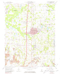
Historical Maps of Freeman Spur Through Time
Featured Locations
Source Details
SourceU.S. Geological Survey
CopyrightPublic Domain